
Summary
| Landscapes: |  |
| Fun: |  |
| Fitness level: |  |
| Technical skills: | |
Trail in numbers
- Distance: 28 km
- Total climb: 356 m
- High point: 2234 m
- Ridable: 100%
- Duration: 3-5h
Note – the gpx track below includes only the descent.
Highlights
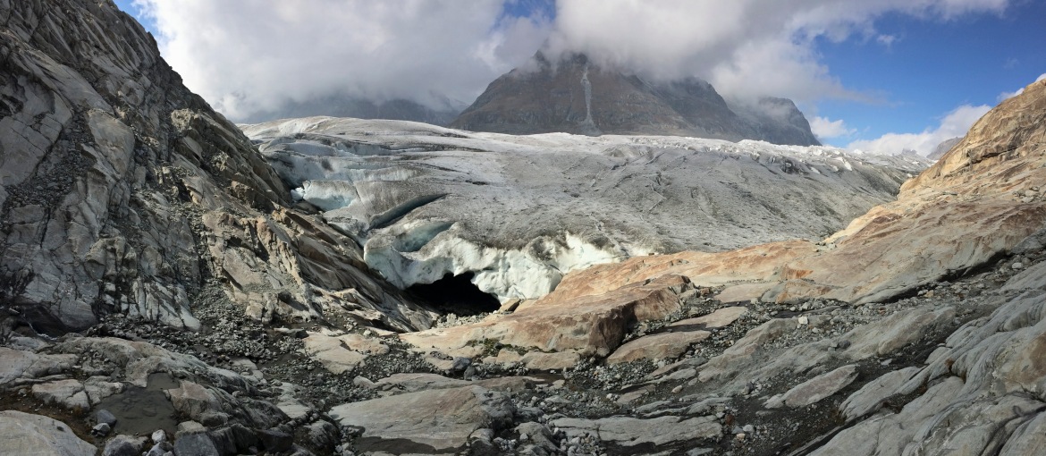
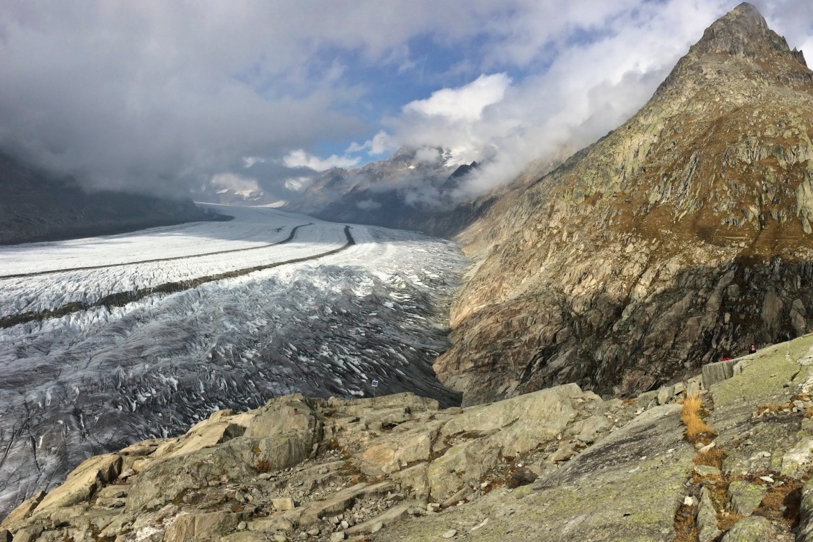
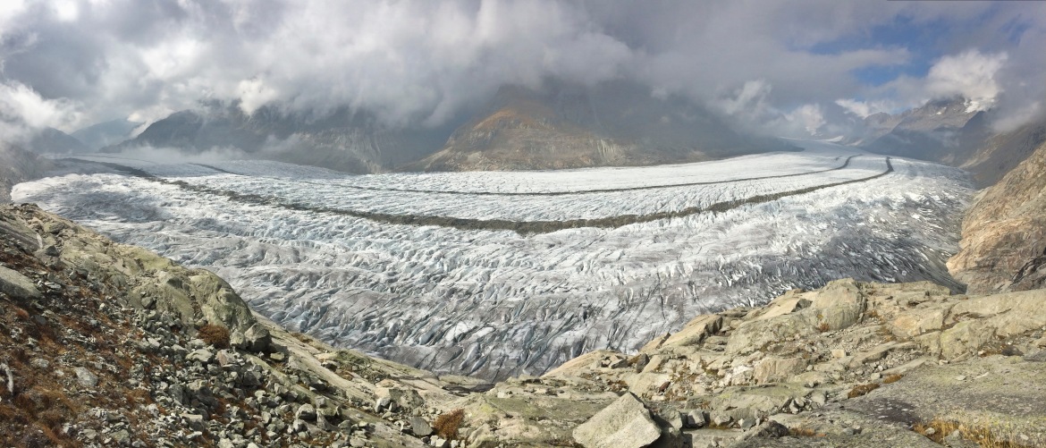
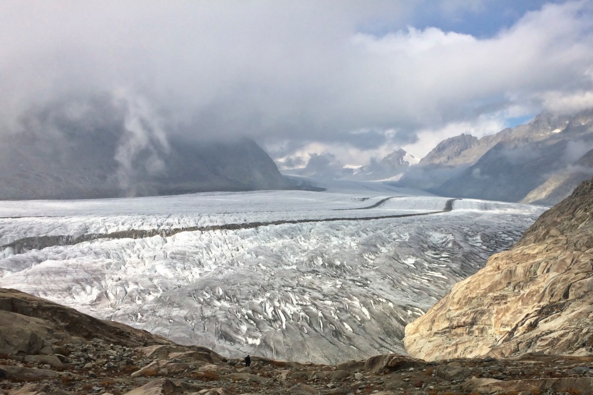
- Aletsch Glacier. Of course this is the star of the trip. This huge river of ice that stretches over 23 km from its formation in the Jungfrau region (at 4000 m) down to the Massa Gorge, around 2500 m below, fascinates and inspires every visitor. The Aletsch weights 27 billion tonnes, or the weight of 72.5 million jumbo jets, and its thickest point surpasses 900 m.
- Gletschertunnel. The Fiescheralp side of the mountain is connected to the Aletsch Arena by a 1 km tunnel, dark and wet. It is very hard to see where the tyre goes in its darkness, make sure you carry a torchlight!
Useful info
- When to go: June to September, depending on snow level. We rode this trail the first weekend of October and got lucky finding no snow, but make sure you check the weather conditions if you want to venture out so late in the year.
- Trail options: we rode the easy way, i.e. we took the Cable Car from Fiesch to the Fiescheralp, which saves more than 1000 meters of climbing – a bliss! Of course, if you feel like pedaling, there is a tarmac road that will take you all the way to Fiescheralp. Also, once you get to the glacier you could climb all the way up to the Bettmerhorn, which is supposedly the best viewpoint to admire the Aletsch glacier. If you do so, you will have to carry your bike for a while, but you will then be rewarded with some thrilling downhill with a unique backdrop.
- Food and Water: you will find all sorts of bars and restaurants at Fiescheralp. Then, after the relatively short ride to the top of Panoramaweg and then through the tunnel, you will find the Gletscherstube Hutte – a mountain hut perfect for a beer break! Therefore, no need to stress over carrying your own food and water.
- Recommended gears&bike: All the panoramaweg is a gravel road that can be easily tackled with a hardtail. It gets a little more rocky and jagged after the Gletscherstunnel, but nothing that a good hardtail and some skills won’t overcome.
- Starting point: Fiesch, Switzerland. It is around 3 hours from Milan, Zurich, Geneve and Basel.
Table of contents:
Photostory
This one has been on the radar for a long time – the Aletsch glacier, the biggest, majestic, and most iconic of Europe. When looking at the pictures of this massive wonder, I would have never thought that it would be so easy to reach it. In fact, if you are looking for a very easy trail that does not require any particular fitness or skills and still delivers the thrill of real mountains, look no further: this is just the trail for you.
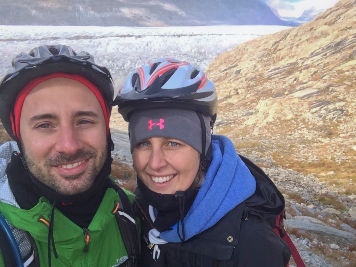
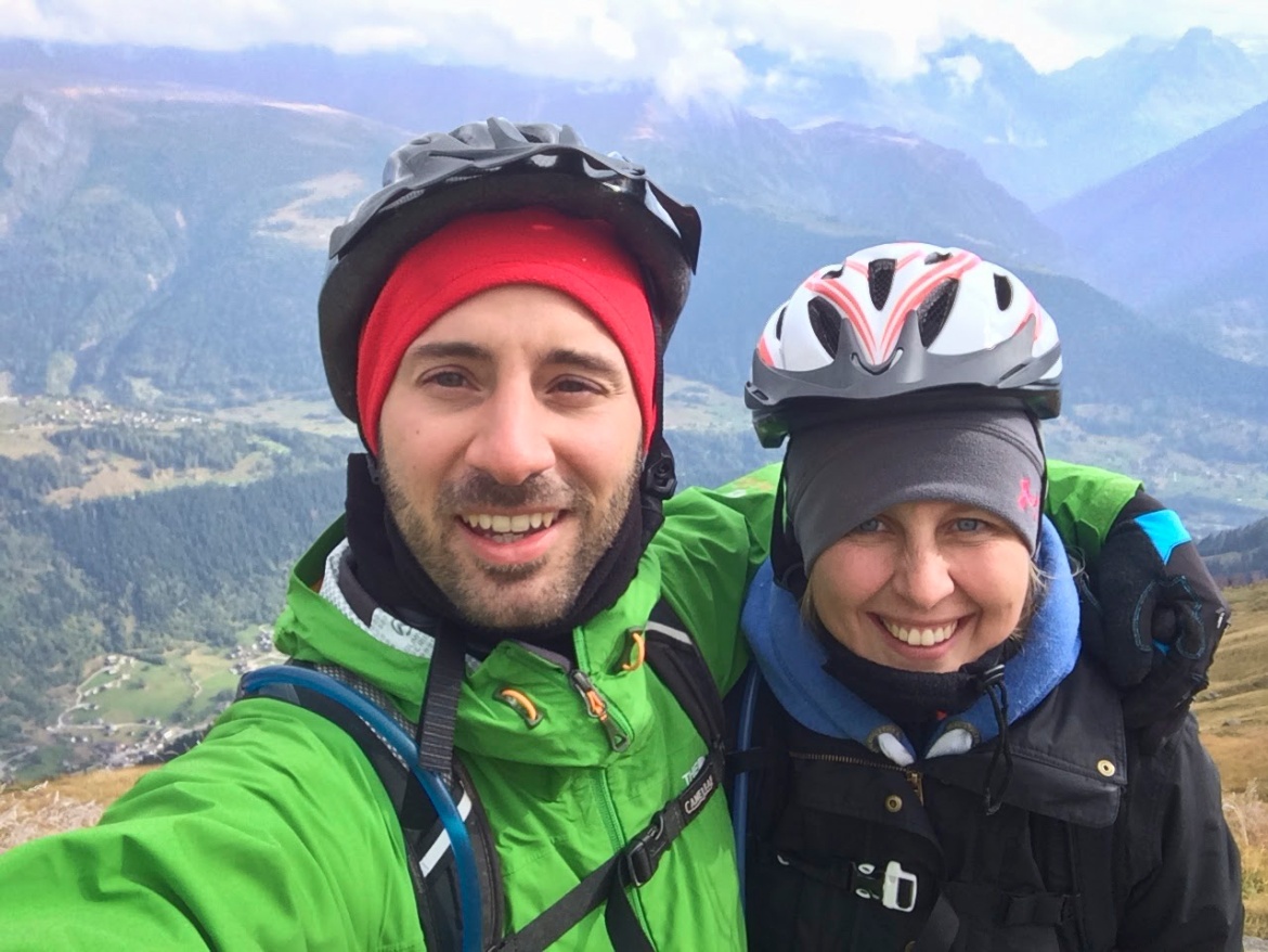
Maria and I have been planning this trip for long, but never succeeded to make it work. I always thought that going to the Aletsch would require detailed planning, traveling in advance and investing a few days, endless hikes and almost unridable rocky trails. Finally, well after the end of the summer season, Maria proves herself right and shows me that this would actually be a very good location for a daily trip, also being almost halfway between Milan and Basel.
It is an October weekend and the forecast is not great. Actually the weather patterns are very patchy, with neighboring valleys showing drastically different conditions. However it is supposed to be acceptable in the Wallis Swiss canton, so we decide to go for it. Not long after departure from Milan, we experience our first second thoughts: the clouds are grey and low in the sky, and it looks as if the conditions get worse as we approach our destination.
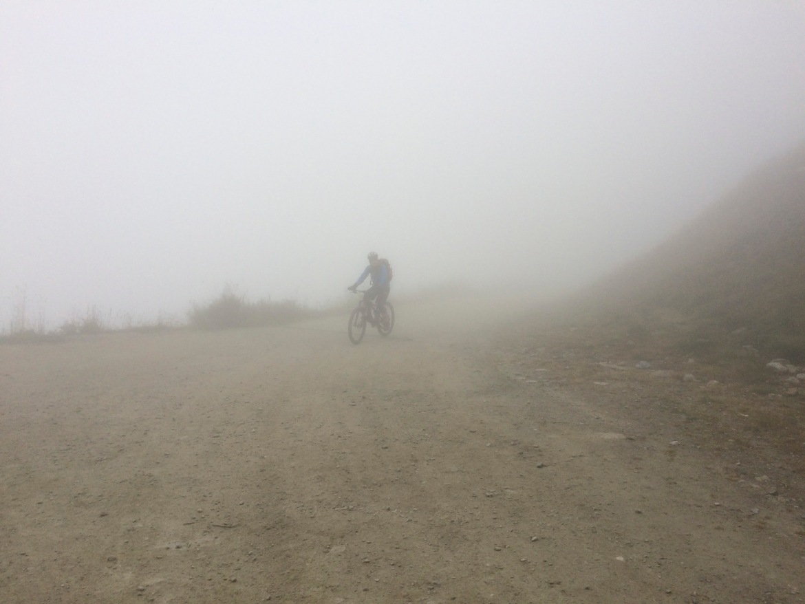
Just before the Swiss border, we hit a massive storm which makes us wonder what the hell we were thinking when we decided to go on this expedition. As we climb the Simplon pass the visibility drops to zero because of the fog, and the thermometer shows freezing temperatures. Still optimistic, we believe that as soon as we descend and enter our destination valley, things will get better.
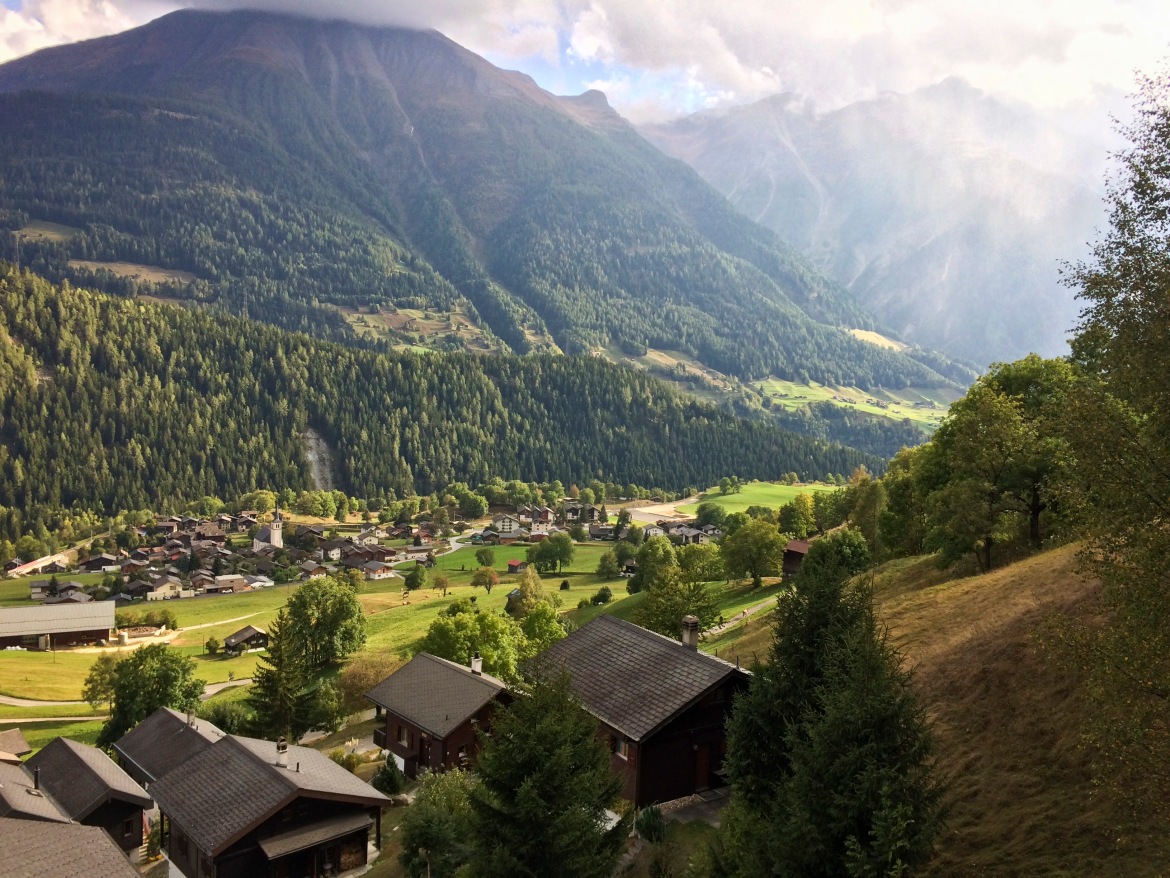
The destination is Fiesch (~1000mt), a small Swiss village at the feet of the Eggishorn (2927 mt) – the best viewpoint for the Aletsch glacier together with the Bettmerhorn. As soon as we get there, we realize we have been over optimistic: the weather is unforgiving with cold, humidity, fog and clouds all over the place.
However, we are both too stubborn to accept that we have poorly planned this trip, so we purchase the cableway tickets to the Fiesch Alp (~2200mt), an ever smaller village in the middle of the ski pistes, with many cozy chalets and restaurants. Well, at least that is what we infer looking at the posters and tourist brochures, because in reality we cannot see absolutely anything.
The fog is so dense that the visibility hardly goes beyond 5 meters. I check our position on the GPS app of my phone, we should be very close to the starting point of the trail, however we can see no trail at all! I try to follow my intuition hoping to stumble into it , but without success. Finally we have to ask for indications in a hotel reception, and with a lot of effort we are able to make our start.
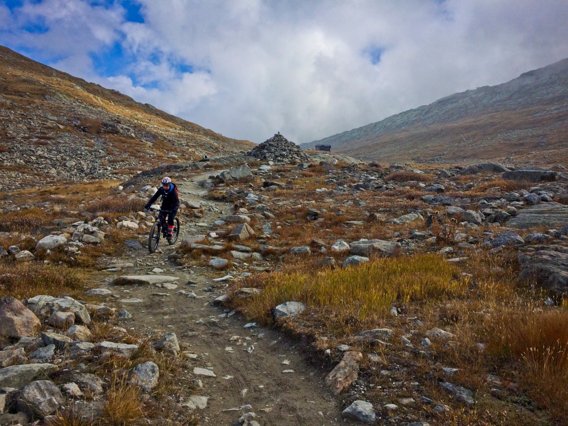
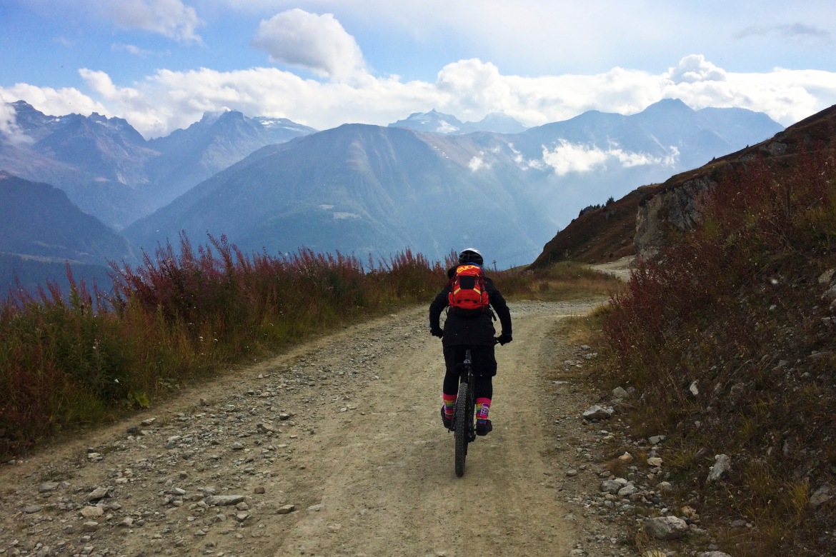
The climb is very easy, on a gravel road with a very grippy terrain. It is frustrating to notice many lookout points signaled, where the only thing that we can see is a wall of fog.
After some 200mt of elevation gain, we bump into an unexpected tunnel – something probably built during the war that connects the Fiesch valley with the Aletsch valley on the northern side.
Once on the other side, a miracle! The clouds are so heavy and low that cannot overpass the mountains slightly above us (2600mt). What a beautiful sight to see a patch of blue sky!
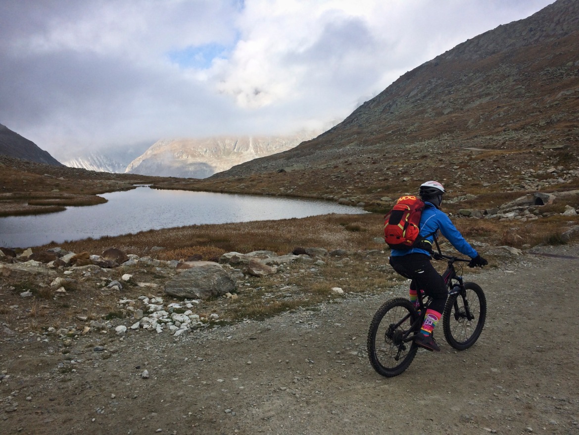
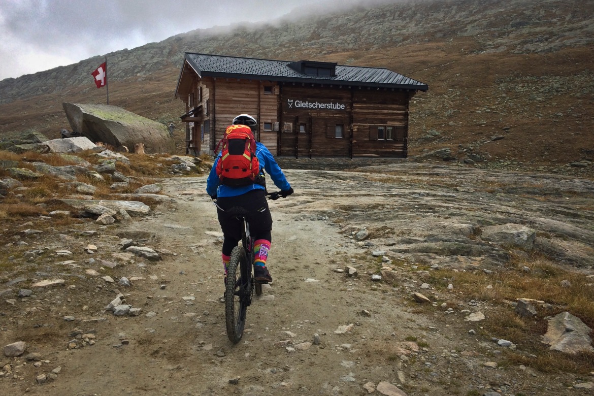
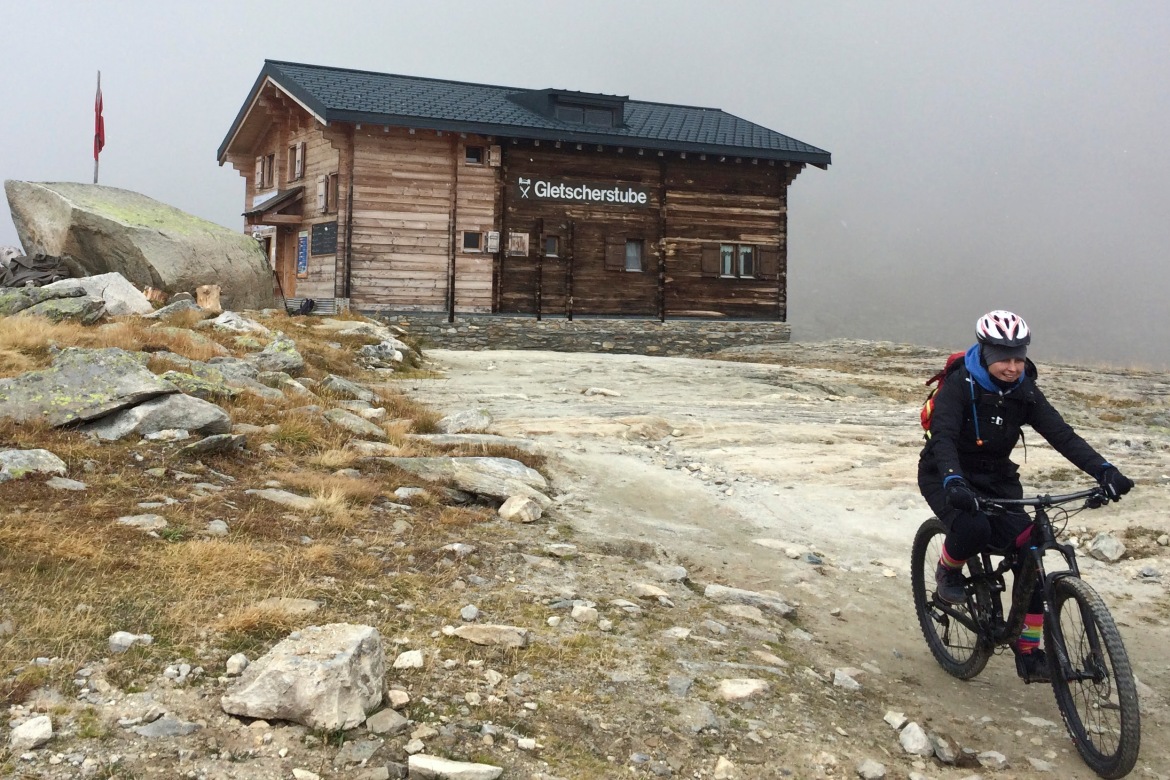
There is also a cozy mountain hut – the Gletscherstube Marjelen.
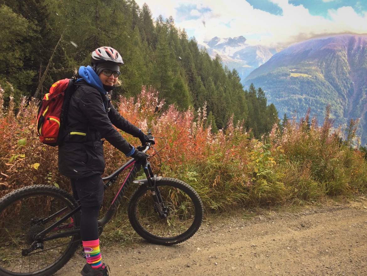
We decide to follow the trail towards the glacier, to see if it is ridable. Looks like it is!
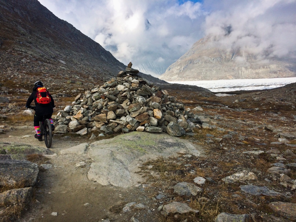
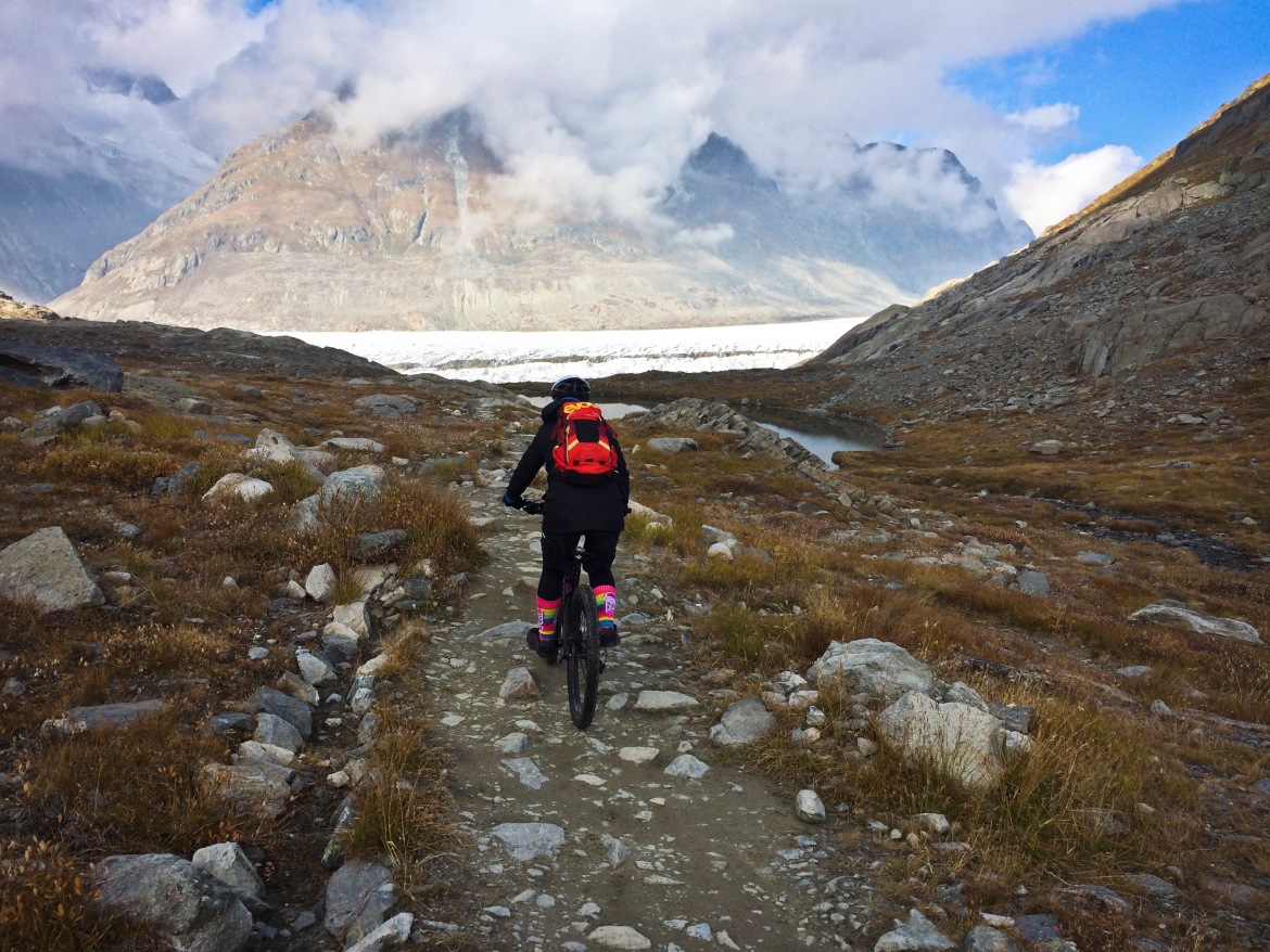
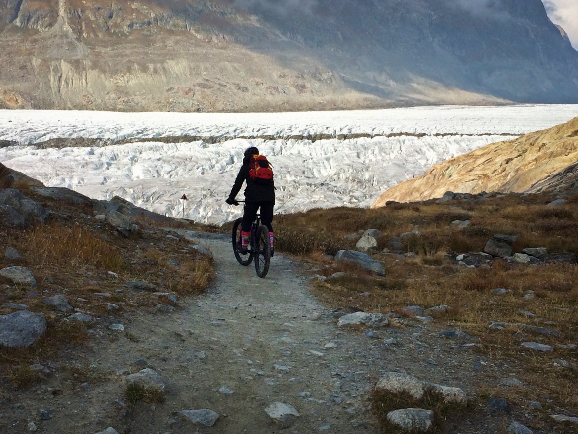
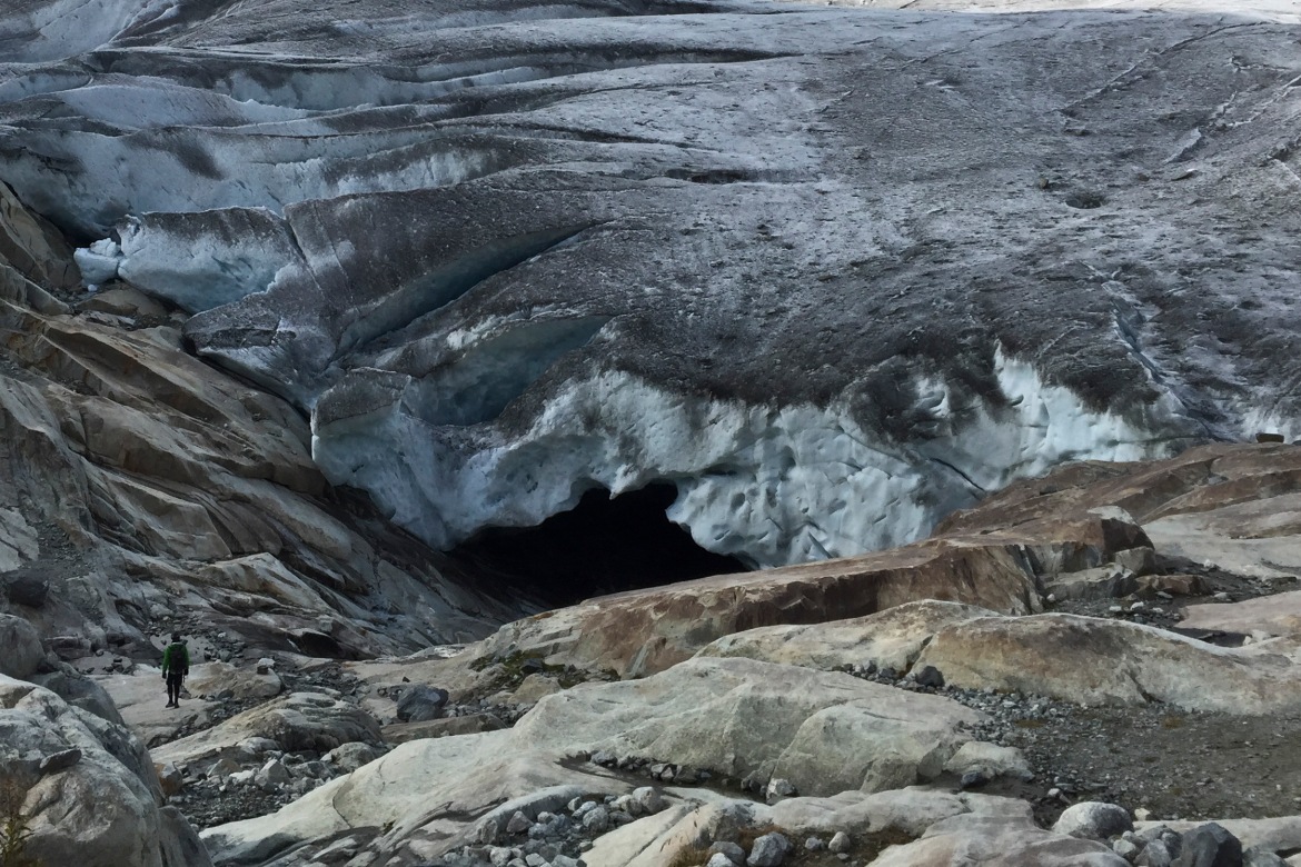
We finally reach the glacier. It is massive, almost scary but wonderful at the same time. We decide to get even closer to have a closer look, and we realize that there is an opening on the bottom of the icy surface, and we can’t help but go inside.
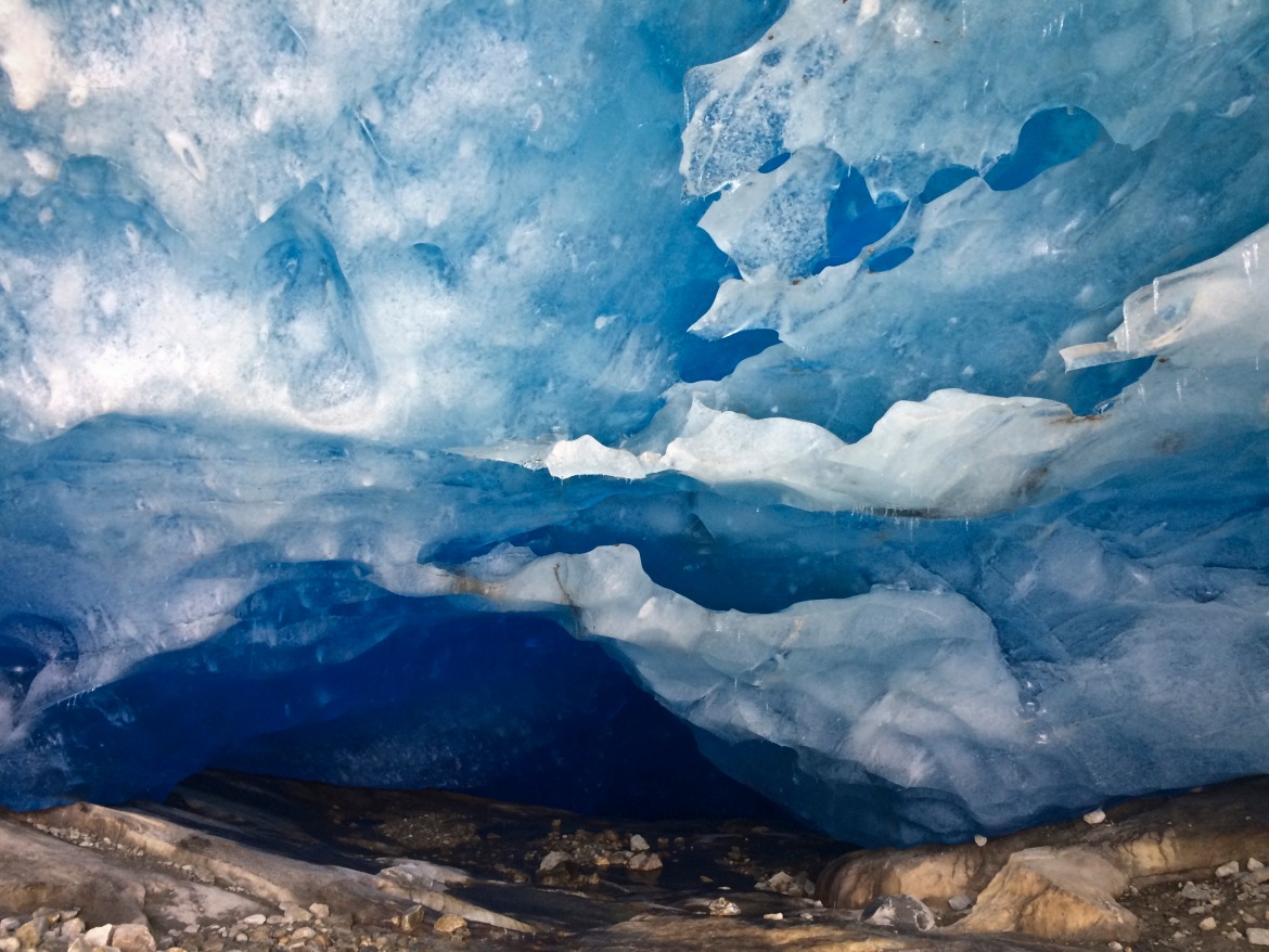
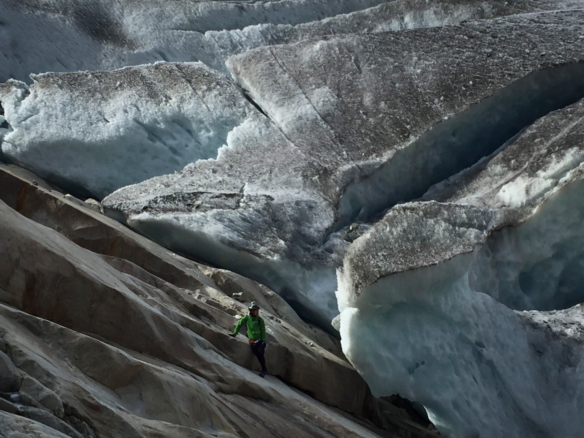
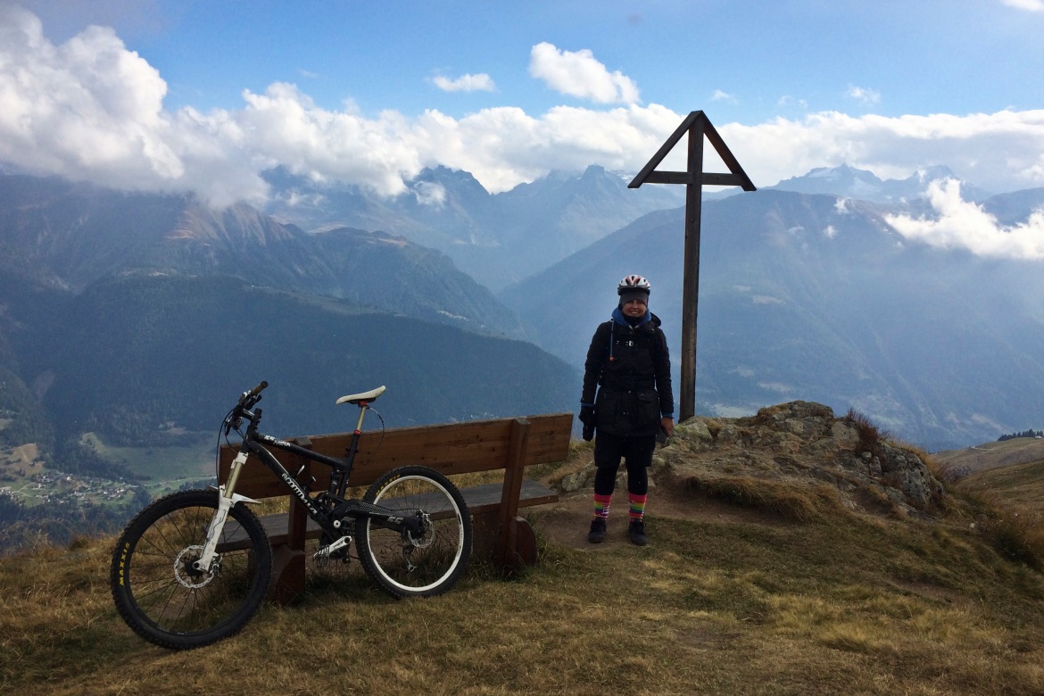
After spending almost one hour mesmerized in wonder, contemplating this huge mass of ice and photographing it from every possible angle, we go for higher grounds to get our panoramic shots:
All of a sudden, the clouds that we have left behind before begin to close in around us once again. The view is gone, and we go back to the mountain hut for a well deserved beer.
Now even this side of the mountain is covered in fog. Calling it a day, we revert and go back through the tunnel from where we came from…and once more what a surprise! The weather has changed and finally we can enjoy some views from the viewpoints noticed on the way up!
Maps and Stats
Max elevation: 2364 m
Total climbing: 356 m